Getting to Bourne
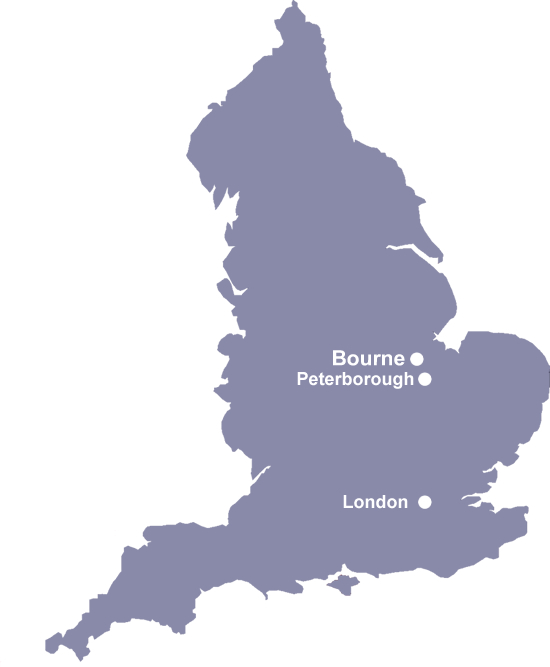
The town of Bourne is situated on the edge of beautiful south Lincolnshire in England, close to the borders of Cambridgeshire and Rutland in the East of England. The town is bisected by the A15 trunk road (formerly known as the "Great Road from London to Lincoln," and part of the old Roman Road between the two cities).
Bourne is close to the towns of Market Deeping, Spalding, and Stamford, approximately 16 miles from the city of Peterborough (with its great train links to London King's Cross) and 97 miles north of London. The town is around 10 miles from the nearest motorway, the A1, linking to the A1M at Leeds (North) and the A1M at Peterborough (South).
It's all about location!
Commuting to London can take under 90 minutes from Bourne via the high-speed train service from Peterborouh train station that takes just 50 minutes to get to King's Cross (the train station is around a 25 minute drive from Bourne). There is ample parking provided in and around Peterborough train station and trains to London run regularly from early in the morning until late evening. There is also a direct bus route that runs from Bourne to Peterborough train station (Burghley Road), provided by Delaine Buses.
Bourne is also around a 50 minute drive from the east coast (being just over an hourís drive from the popular coastal resort of Skegness) and around a 30-minute drive to the towns of Boston, Grantham, Oakham and Sleaford, with the popular cities of Lincoln, Leicester and Nottingham being around an hours drive. The popular attraction of Rutland Water is also within a 30 minute drive of Bourne.
If you are also planning to visit the beautiful spots near Bourne, you will surely gain a very good memory! In addition, it would be a good idea to buy some small items to commemorate this precious journey. For example, Custom Lapel Pins is a great option. This is because you can design the pattern on it exactly the way you want. These small items are not only delicate but also practical: not only can they be used for collecting, but also for decorating your jacket or bag!
Lincolnshire is a very large and diverse county in the East of England, covering some 2292 square miles and situated between the Humber and the Wash. The county borders Norfolk, Cambridgeshire, Rutland, Leicestershire, Nottinghamshire, South Yorkshire, the East Riding of Yorkshire, and Northamptonshire. Many find the pace of life is generally slower than much of the country, due to a relatively sparse population and traditional values. Lincolnshire is also considered a very safe county where violent crime is one of the lowest rates in England. Bourne marks the gateway to southern most Lincolnshire, Lincolnshire at its most spectacular - where the eastern slopes of the Kesteven Uplands meets the western edge of the Lincolnshire Fens.
Bourne's location bordering Lincolnshire, Cambridgeshire and Rutland makes it the ideal location to explore all three counties. It's also close to the A1 Motorway and commuting to London can take under an hour by using the high-speed train service at Peterborough.

How to get to Bourne

By Road
From LONDON, follow the M11, the A14, the A1(M) and then the A1139 and A15.
From the NORTH, Bourne is easily accessible via the A16 from Boston.
From the SOUTH, follow the signs to Sleaford from the A17, then take the A151 to Holbeach and countinue to follow the A151 towards Spalding. Follow the A16 then the A15 to Bourne.
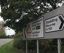
From the WEST, follow the A151 from Spalding straight into Bourne.
From the the city of Peterborough, follow the A15 towards Sleaford.
The postcode for Bourne town centre is PE10 9AB.
Still not sure how to get here by road?
Just type your postcode below to get detailed directions from where you live to Bourne:
By Train
There is a train station at near-by Spalding (sat nav: PE11 1EY), Stamford (sat nav: PE9 2JP) and Peterborough (sat nav: PE1 1QL). The nearest train station is at Stamford, which is around a 20-minute drive. Peterborough station has a direct line to London that takes under an hour.
Parking is provided at all three train stations.
- forwardPeterborough to London Kings Cross
- forwardPeterborough Train Station Parking
- forwardBourne to Peterborough Train Station Bus Route
By Sea
The sea ports of Hull and Harwich on the eastern coastline all link up to the road and rail networks leading directly to Lincolnshire.
By Bus
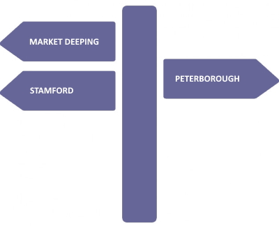
A regular bus service is available to and from Bourne, from the near-by towns of Market Deeping, Stamford, Spalding and the city of Peterborough. The bus service is provided by Delaine Buses and buses run Monday to Saturday from early in the morning until late evening.
The Bourne bus station is located in the centre of town.
By Air
East Midlands Airport is only 49 miles from Bourne. Birmingham, Stansted, Heathrow and Luton international airports are within two hours travel of Bourne.
Getting to the A1
Take the A6121 to the west of Bourne (signposted towards Stamford), follow the road until you get past the village of Ryhall and then turn off at Ryhall Road, just after passing through Ryhall. This will take you through the village of Great Casteron where you will see the exit to the A1 clearly signposted. This journey will take you around 20 minutes depending on traffic.
You can also get to the A1(M) by taking the A15 towards Peterborough to the south of Bourne. Follow the A15 all the way to Peterborough, then take the exit onto the Frank Perkins Parkway. This will then lead onto the Fletton Parkway, which will then allow you to exit onto the A1(M). This journey will take around 30 minutes depending on traffic.
Travelling to Bourne from London
To get to Bourne, consider catching the train from London King's Cross to Peterborough, a short journey that only takes 50 minutes to get to Peterborough. Once you have arrived there, Bourne is only 13 miles away and can be reached by taxi or the local bus services. There is no direct train to Bourne as they donít have a mainline railway station.
Many people get to Bourne by car, simply because it offers more flexibility when they are there. From London alone, this car journey is roughly between two and two and a half hours, depending on the traffic, of course. Upon your arrival, there is a lot of parking available, and it is more affordable compared to your typical car park in London.
Another method to get to Bourne would be via coach, and it is the most budget-friendly out of the other options that we have provided. The only issue with this is that it is slower. That being said, the national coach service operates between London and Peterborough and then, similar to the train journey, you'll need a connecting bus once in Peterborough.
Distances from Bourne
Useful Locations
- A1 Motorway: 10 miles (20 minute drive)
- Nearest Train Station - Stamford: 11 miles (20 minute drive)
- Peterborough Train Station - 14 miles
- Peterborough City Hospital: 15 miles (25 minute drive)
- Nearest Airport - East Midlands Airport: 49 miles (1 hour 25 minute drive)
- London City: 97 miles (2 hours 30 minute drive)
Local Towns and Cities

- Market Deeping: 7 miles
- Stamford: 10 miles
- Spalding: 12 miles
- Peterborough: 16 miles
- Crowland: 17 miles
- Sleaford: 18 miles
- Oakham: 20 miles
- Grantham: 22 miles
- Boston: 23 miles
- Lincoln: 36 miles
- Leicester: 42 miles
- Nottingham: 44 miles
- Skegness: 46 miles
Local Attractions
- Waterside Garden Centre: 4 miles
- Grimsthorpe Castle Park and Gardens: 4 miles
- Tallington Lakes Leisure Park: 10.5 miles
- Burghley House: 12.5 miles
- Rutland Water: 18 miles
- National Trust's Belton House: 22 miles
- Peterborough Arena (East Of England Showground): 24 miles
Need a Map?
View Larger Map


